Naval mine – Well
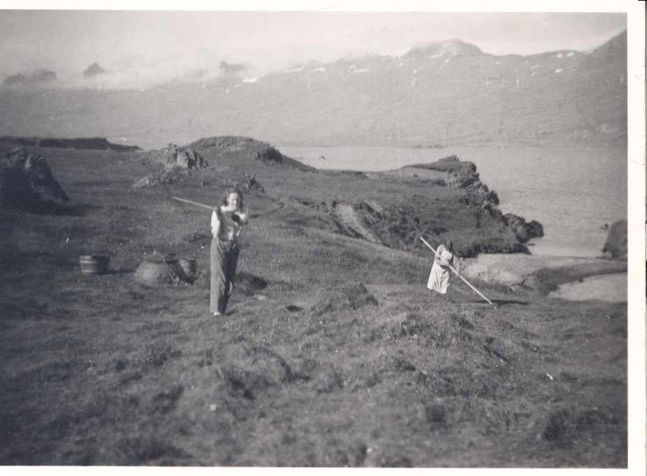
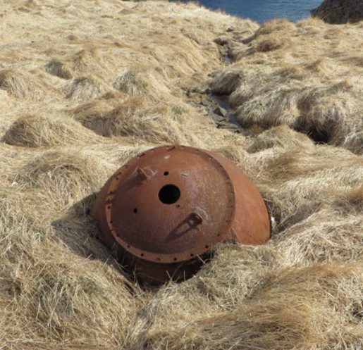
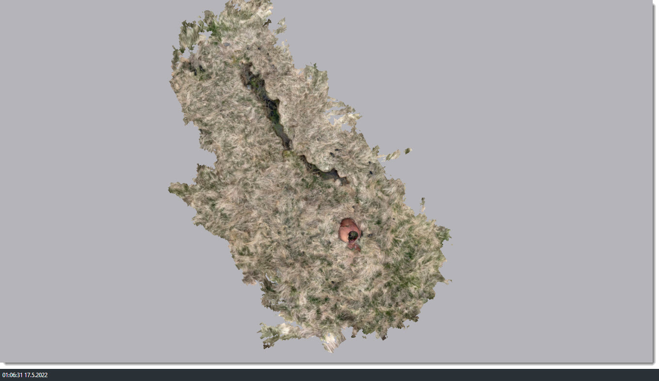
The well in Brunnfjara is located at 64°40.609N 14°20.626W. The shores name Brunnafjara is associated with a good well in the field,“ according to the place name registry. The well is marked on the field map from 1919. It is about 50 meters northeast of house 002 and about 250 meters southeast of farm 001. This well was likely not made until after the farm was moved from the old farm site 001 at the end of the 19th century. It is not known where the well was before the farm was moved. The well is in the field, the part that has been left untouched. It is sloping towards the east, towards the shoreline. From the well, a channel extends up the slope, formed by the water flow from the well. On top of the well is a shell of an old naval mine that has been there for a long time and, for that reason, one cannot see inside the well. It has likely been filled with rocks, but it is not known how deep or wide it was.
Safety note: caution due to construction. Sources: Ö-Teigarhorn, 1; Field Map 1919.
Source: SM-239:017 fornleyfaskráning í landi Teigarhorns 2015